As I sat down to write this entry, I was surprised as to how difficult I found it to accurately describe the month I spent in Alaska. Despite all my travels this year, from Central America to the center of Wyoming to the South Pacific, I never had such a challenge writing about my experience. It could be that I feel the need to ensure that those who read this blog will fully understand and grasp the scope of this expedition. Possibly it was the fact that I needed some time for it to truly sink in. Either way, I am left with the recount below, which can in no way do justice to the 30 days spent on the mountain. Hopefully, it can help to illuminate my life up there in pursuit of North America’s highest peak.
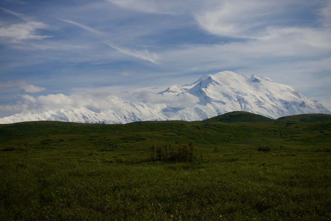
Why do we climb? What drives us upward in the effort to reach the summit? Why do we punish ourselves through physical pain and mental challenges day after day? Is it the desire to reach the farthest corners of earth? Maybe it’s the human race’s continuous struggle to assert their dominance over Mother Nature. Or is it simply due to their presence, as George Mallory was famously quoted “Because it’s there.” No matter the reason, somehow I found myself at the Anchorage airport, getting ready to make a summit attempt of Mt. Denali.
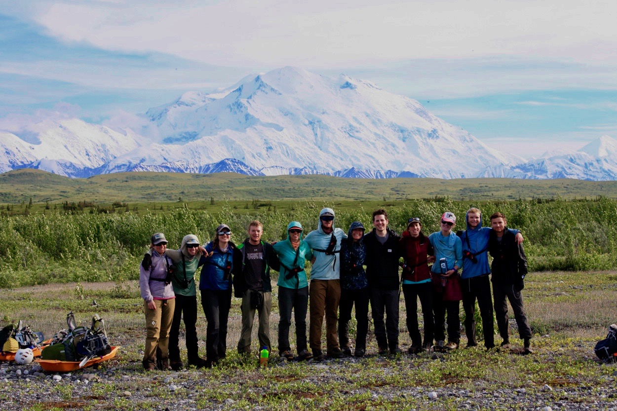
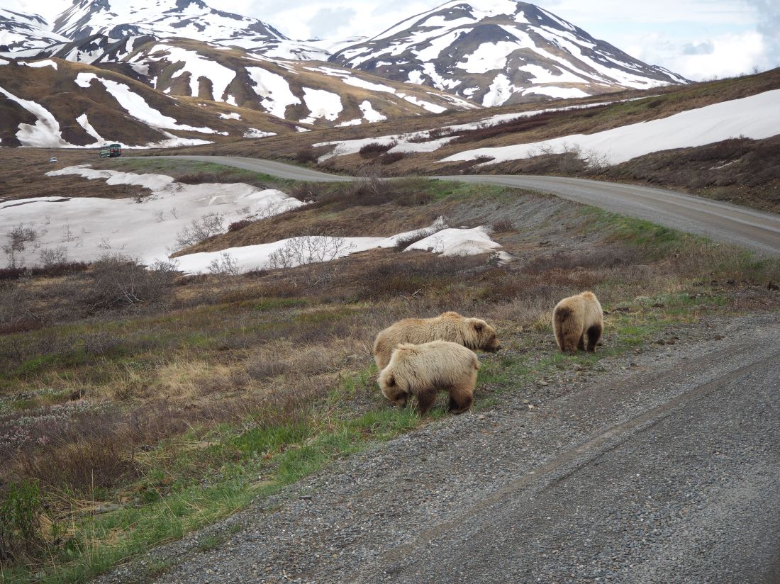
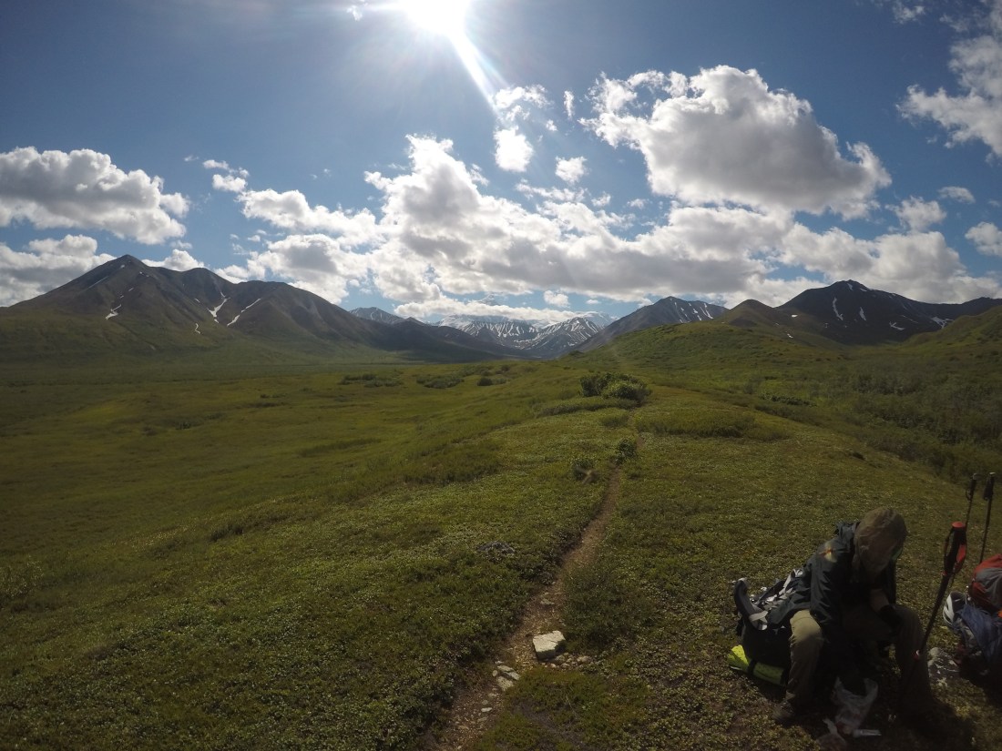
The following two days were filled with introductions, ranger briefings, gear rentals, route overview, and packing. Then, on the morning of June 8th, we found ourselves on the Denali National Park camper bus destined for Wonder Lake. After six and a half hours of grizzly bears, caribou, moose, and gorgeous landscape views, we arrived at the head of the McKinley River Bar Trail. This well-maintained, two mile park trail is often used by day hikers who want to get a glimpse of the river before returning to the park entrance via the bus. After almost a year of thinking about this trip and months of planning, I was standing at our starting line. I had no idea what the next 30 days had in store, but I was excited to take that first step forward.

McKinley River (1,500 ft) to McGonagall Pass (5,985 ft)
Unlike the frequent day-hikers, we did not stop at the bank of the river. And despite the thunderstorms and hail pouring down from above, we continued forward into the mile wide river of waist high, rushing glacial waters. We moved slowly as we were forced to move horizontally through the 70 channels using a tripod position to increase our balance as we crossed the icy braids. A little over an hour later, we arrived on the other side of the river with wet boots and legs but without any incidents.
With the river behind us, the next two and half days up to McGonagall Pass were fairly straightforward. We simply followed the climbers trail for around twenty miles up through the marshy tundra and continued to gain elevation as we neared the pass. As we would soon learn with everything on this expedition, what seemed easy rarely was. Due to our massive backpacks (most of our packs weighed about 80 pounds), thick brush, multiple bouts of pouring rain, numerous deep stream crossings, and a narrow trail, these miles up to the pass were certainly not without difficulty. On the morning of the third day, we hit snow about 2000 vertical feet below the pass. We strapped on our snowshoes and continued climbing, passing half of our cache along the way. A couple of hours later we caught our first view of the Muldrow Glacier as we hiked over the pass, and with it was the realization that we were truly going to try and climb this mountain. Unfortunately, not all of us would be continuing up the glacier. Due to some medical issues, two of our group members decided that this was not the right time for them to make an attempt. Thanks to a support team that was camped a day behind us, these members were able to return back to the trailhead while the 13 of us pushed on.


McGonagall Pass (5,985 ft) to the Base of the Lower Ice Fall (7,000 ft)
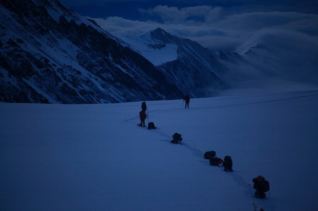
Upon our arrival at the pass, we set up camp and then returned back down over 1000 vertical feet to retrieve the majority of our cache. Consisting of 20 wooden boxes and over 800 pounds of food and gear, this cache was brought up by dogsled teams at the end of the spring when the river was frozen over. Once we had the entirety of the boxes at our camp, we began the slow process of unscrewing over 2000 screws and organizing our food for the rest of the journey. This organizational period lasted over a day as we separated, divided, and bagged our rations for the climb. When everything was ready to go, we ferried the first load to the base of the Lower Ice Fall.
That day we started a pattern that would continue essentially until we reached the summit. Since we had a literal (yes, literal) ton of food and gear to carry, and only 13 people, it would be impossible to move everything in one push. To solve this issue, and to benefit our bodies acclimation to the elevation, we would climb up to our desired camp location, bury our cache, and then return down that same path to our camp to spend the night. The next morning, we would take down our camp, pack everything up, and move back up to where we had dropped the cache the day before. While a bit frustrating at times (it’s never fun to climb all day and know that you have to go right back down), this process was our recipe for success and enabled us to move up the mountain with everything we needed.
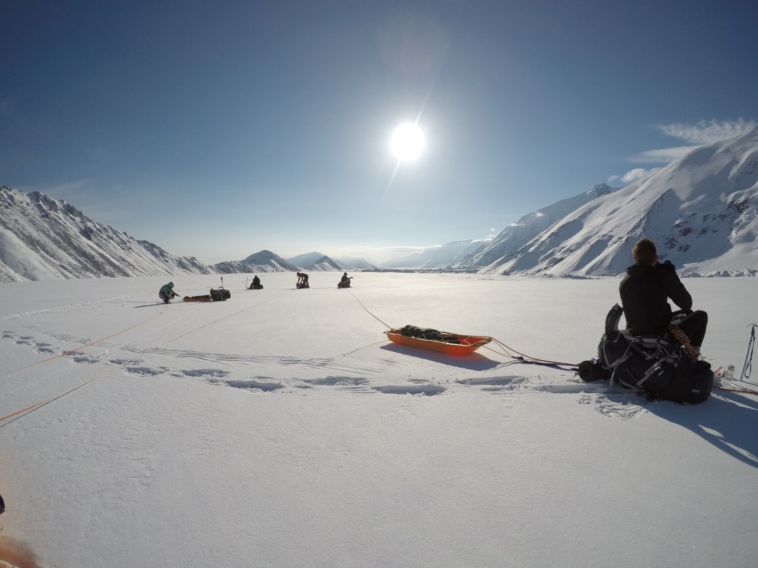
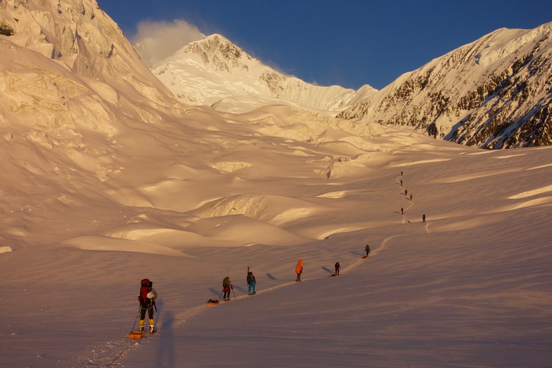
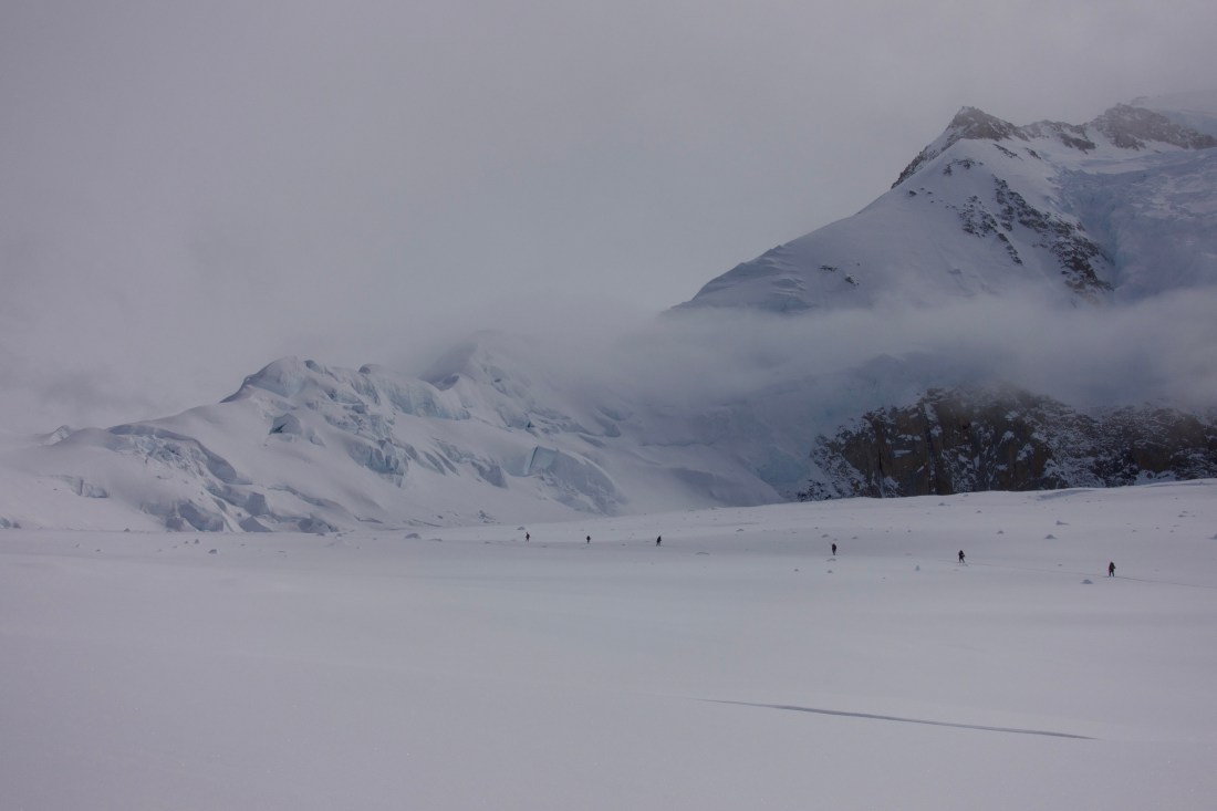
The move from McGonagall to the Lower Ice Fall was a pretty simple one. We familiarized ourselves with our rope systems, snow/ice gear, rope team travel, and glacier travel as we made the six mile trek across the mostly flat glacier up to the base of the icefall.

Base of the Lower Ice Fall (7,000 ft) to Base of the Great Ice Fall (9,000 ft)
Thanks to the route we set the day before and an early wake up, we were able to move much more efficiently and therefore arrived at our camp below the icefall before 10:00 am. Normally, this would mean hours of free time to relax and reenergize. However, the only way to move through the Lower Ice Fall is on the moraine alongside the glacier itself, as the towering ice walls and deep crevasses make the ice fall itself impassable. Because of this challenge, we would be side hilling below an area with massive overhead hazards such as rock falls, avalanches, and massive seracs. To mitigate some of the risk, we had to travel at night when temperatures were cooler and the subzero temperatures would hopefully keep our hazards frozen above us. So, after arriving at our camp, we had a couple of hours to eat, relax, dry our stuff, and enjoy the first sunny day of the trip.
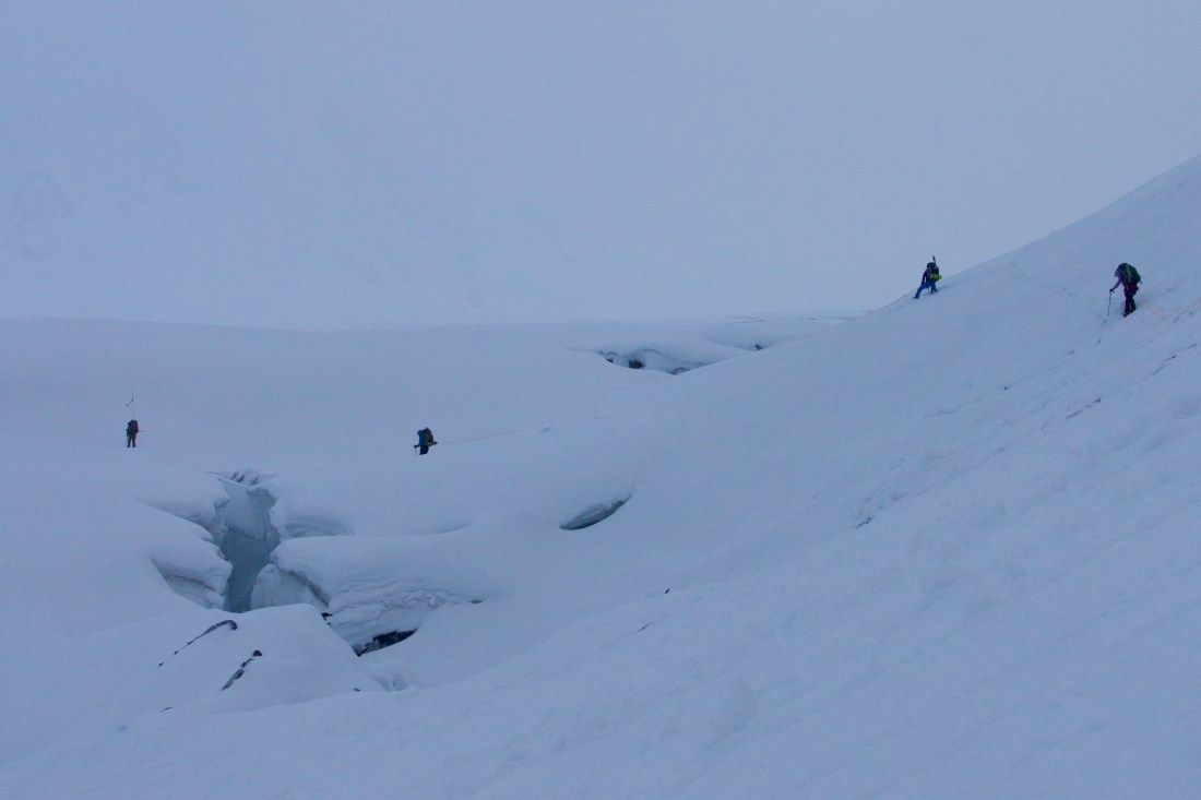
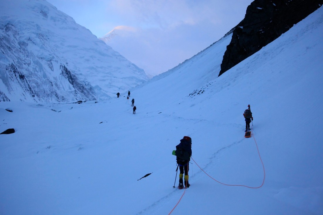
The move itself to the base of the Great Ice Fall was incredibly challenging. We actually moved camp before the cache for this move (this would be the only time we broke our normal pattern) and on the first day I was one of a few people carrying a sled full of gear in addition to my backpack. As a result of hiking along the angled hill, my sled was legitimately dragging me down the mountain, and it was pretty brutal hauling it all the way along the icefall. We finally moved past the last ice walls of the icefall and were able to push the rest of the way on the glacier itself. The last section of this push was through the Hill of Cracks, a dynamic and ever-changing section of the Muldrow where the glacier flows over a large convex role, creating a maze of crisscrossing crevasses. While it sounds intimidating, thanks to a deep snowpack and cold temperatures, we were able to move pretty efficiently to our desired camp spot.
The highlight of these two days was our luck with the weather. Both days we had clear skies and we were treated to some of the most beautiful sunrises and sunsets I have ever seen since we were moving at night. I can still picture the vivid orange and red hues cast against the white backdrop of the mountain in front of us while the sun itself hovered above the glacier and smaller mountain ranges below. It was certainly a treat to be able to hang out at camp during the day and appreciate the warm sun as opposed to climbing in it.

Base of the Great Ice Fall (9,000 ft) to the Base of Karstens Ridge (10,500 ft)
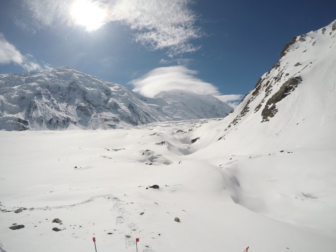
If I thought the move up the Lower Ice Fall was tough, I had no idea how much harder moving through the Great Ice Fall would be. Our first day moving up the icefall was a 23 hour day, and we didn’t even drop the cache as far as we wanted to. There were numerous reasons why this push took so long, but it’s really because of two things, incredibly difficult route finding, and crevasse rescues.
Since we started once again with a 9:00 PM wake up, the first few hours of the day were spent trying to find the route in limited light. Even in the land of the midnight sun, between midnight and 4:00 AM it’s a little dark, and anyone who has been skiing can attest to the difficulty of reading snow in poor light. To make matters worse, the Great Ice Fall is one of the hardest sections of the climb, due to towering ice structures and frequent crevasses. We were forced to wind through these obstacles as best as we could, essentially using trial and error to find our way. Sometimes we had no choice but to go right over a small ice wall, or walk around a large crevasse. However, even when 10 people have walked on the path in front of you, no step is guaranteed. I found myself 10 feet below the surface of the glacier, dangling in a crevasse, my nine millimeter nylon rope and my teammates above the only thing keeping me from falling to my death in the seemingly bottomless blackness below. Luckily, I was able to get hauled out and I thanked my rope team as we regrouped and continued forward. Just a couple hours later, our course leader Jesse fell into to her own crevasse, and while her teammates were able to act fast and self-arrest, the positioning of the crack, along with the rope drag and the amount of cut-in led to her falling over thirty feet to the bottom of the crevasse. It took over two and a half hours to get her out, but we were glad to have her on the surface again and we pushed on. We didn’t know it at the time, but she actually broke two ribs during this fall, and yet continued to climb the mountain.
At this point our visibility was pretty bad; we had been hiking for over 18 hours and it was the heat of the day, so despite being about a half mile short of where we were hoping to camp, we decided to drop and bury the cache. We then descended all the way back to our pre-existing camp, and caught up on sleep as we prepared to retrace our steps in the morning. When we reached the drop site of the cache the following morning, we were excited to have nearly arrived at our camp. However, what we thought would be a quick half mile ended up taking over seven and half hours due to the impossible route finding and white-out conditions. When we arrived at camp at 7:30, we knew we had to go back and get the cache so we could continue to climb the following morning. We also wanted to get camp set up, so we split the group in two and seven of us headed back down to get the cache. Essentially carrying double loads, we hauled full sleds and over a hundred pounds in our packs back up to our camp.


Base of Karstens Ridge (10,500 ft) to Karstens Ridge (12,000 ft)
Our camp at the base of Karstens ridge was in a pretty spectacular location. We were camped at the very end of the Muldrow, giving us breathtaking views of the glacier below, while also being surrounded on three sides by steep walls leading to the summit. Despite my exhaustion, I was able to appreciate this beauty as we arrived at the col (the lowest point of a ridge).
Instead of getting up at 8:00 the following morning to start moving up the ridge, I was woken at 4:30 by the sound of wind hammering into the tent fabric, and a dusting of snow covering my face. While I tried to roll over and ignore the weather, it soon became clear we could not sit by as the storm raged on. My tent mates and I took turns checking the lines of the tent, banging the snow off of the tent, and bracing the poles within. Eventually, our instructors informed us one person should stay inside and brace the poles while the other two built a wind wall out of snow to help protect our shelters. After a few hours of digging and piling snow blocks, we had made a nice horseshoe shaped wall that was nearly my height and was doing a pretty decent job of blocking the wind. We piled back into the tent and tried to get warm, until the wind picked up and changed directions, and we had no choice but to put all of our weight against the tent poles to keep them from snapping. Sitting there against the poles, freezing cold and soaking wet while 65+ mile per hour gales slammed into the side of our tent was one of the least comfortable moments of my life, and the worst part was I had no idea if it would last for five hours or five days. Finally, around 3:00 PM the wind died down and the sun came out, and we were actually able to enjoy a calm afternoon. Aside from some bent tent poles and a bit of digging to find some gear that was buried in the fresh snow, the storm had no effect, other than scaring us. All things considered, we were in a pretty protected spot, and we all knew that if we got hit with that storm anywhere farther up the mountain, we could be in some serious trouble.
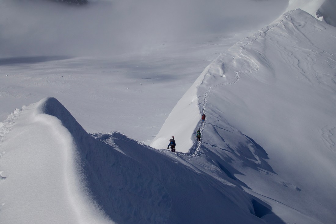
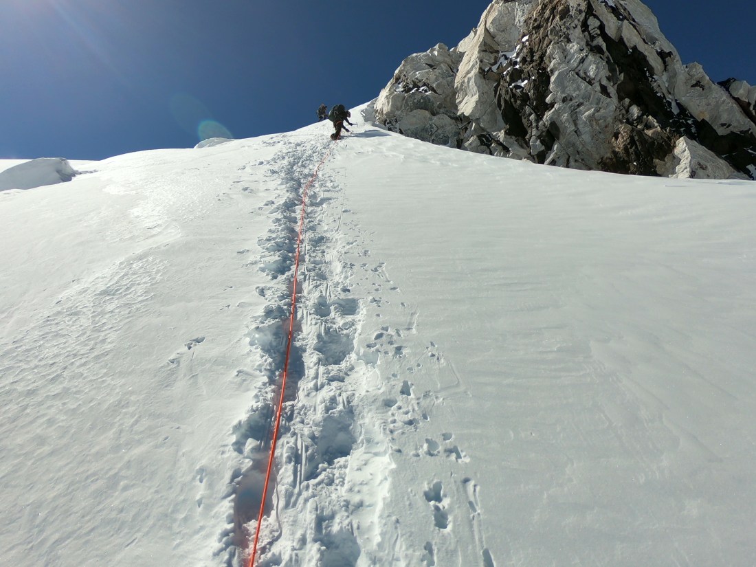
The next morning I did not wake up to the sound of wind; instead, my watch alarm signaled it was time to start moving up the ridge. Once we gained the slope up to the ridge, we simply followed the ridgeline up. As with everything, this turned out to be harder than it sounds because of the knife-edge ridge, near vertical ice-walls, steep ramps, tricky footing, and multi-thousand foot vertical drops on either side. It’s pretty unsettling to have to climb for hours on end knowing that one small misstep could send you hurdling down thousands of feet. Despite this, we pushed on, climbing to a flatter and wider spot on the ridge where we would eventually camp. We dropped the cache and a day later we were back at the same spot ready to spend the night. Upon our arrival at this camp, we had to dig tent platforms to create a flat surface, a chore we would repeat at all of the camps further up the mountain. It took hours of digging which is hard enough on its own, but even more degrading on a day that you’ve already been climbing for hours. I was absolutely wrecked when I at last crawled into my sleeping bag, but I was comforted by the fact that I could sleep in thanks to the upcoming rest day.

Karstens Ridge (12,000 ft) to Browne’s Tower (15,000 ft)
After a much needed rest day spent reading, relaxing, and practicing ascending on a fixed line, we were rejuvenated and ready to continue up the mountain. The route for the next move was the entirety of the remaining section of the ridge: three thousand vertical feet of amazingly steep climbing up to Browne’s Tower, and the bottom of the Harper Glacier.
The very first part of this section was called “the nurdle,” and is one of the many cruxes of the route. Basically, the ridgeline leads to an overhanging ice block, and the only way up it is to wrap around the side and ascend an extremely exposed block of blue ice with no traction. To address this very dangerous and challenging section, our instructors put in a fixed line with ice screws during the rest day to ensure that there was an anchor keeping us from falling. After we were above the nurdle, the climbing didn’t get any easier, and we put in numerous pieces of protection such as running pro and snow pickets to take away some risk. We had two very long days on this portion of the ridge, and on the day we ferried the cache we didn’t get back to camp until nearly 1:00 AM. Long days are always hard, but nothing is worse than knowing you only have three or four hours to sleep until you have to get up and do it all again.
As we arrived at camp atop the ridge, our surroundings seemed to jump out at me. It was as if all of a sudden we had gained so much elevation, and I realized how high it felt as I was looking down at all the surrounding peaks. An unfortunate side effect was the majority of the group (including me) now had a pretty persistent mild headache, and we still had to dig tent platforms in the rock hard snow. Hours later when I was finally ready for bed, I could not have been more thankful for the acclimation day ahead and I was very glad to catch up on some sleep.


Browne’s Tower (15,000 ft) to High Camp (17,200 ft)
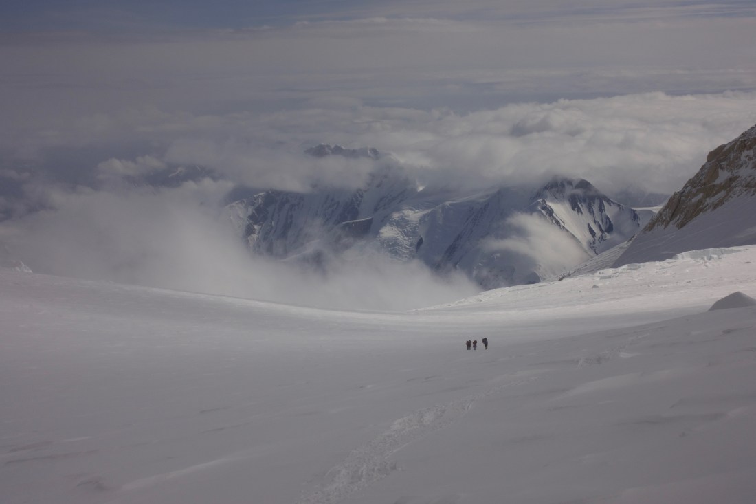
Feeling pretty refreshed post-acclimation day, we strapped on our crampons and made our way toward our last camp. We had received a weather forecast predicting a storm blowing in, and since we could be in a less exposed spot at high camp, we decided it would be best to put ourselves in the position to make a summit attempt and wait out the storm up high. Therefore, we needed to push up to high camp in one day (as opposed to bringing a cache and then our camp), so we took everything we had with us and pushed onward.
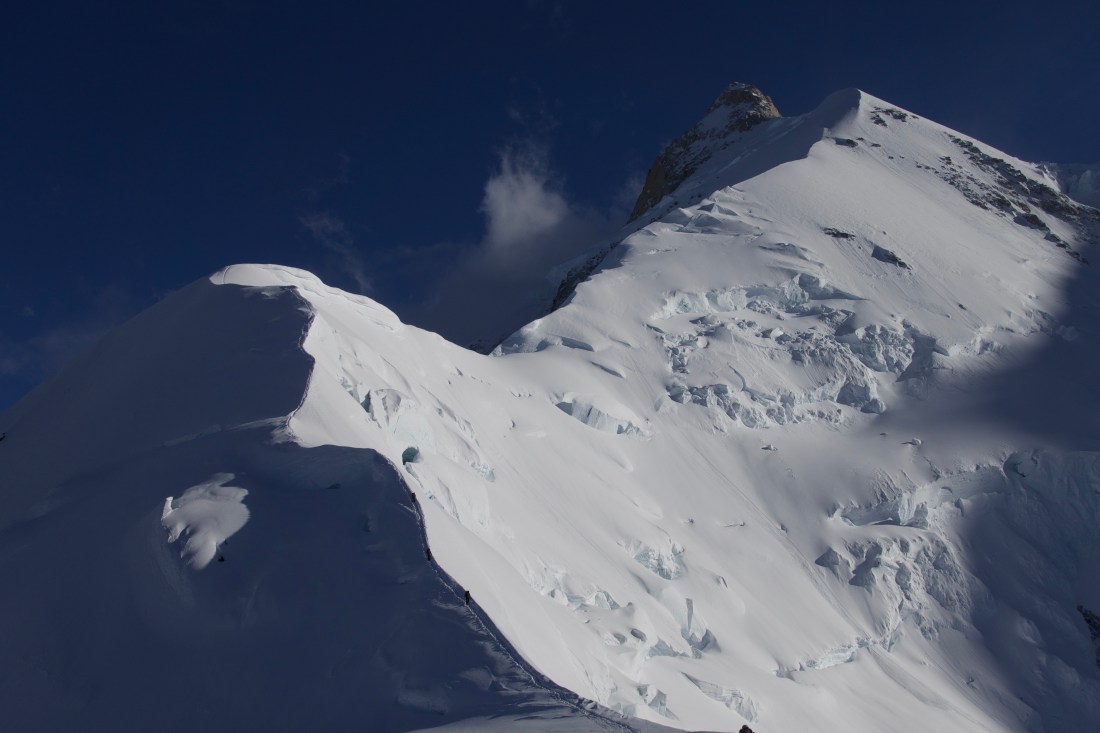
We moved gradually up the Harper Glacier, past the Harper Icefall, and through some tricky sections where many of us punched into crevasses but luckily did not fall beneath the surface. Our progress was slow as we continued to gain altitude, and the tough terrain, growing winds, and steep rises made for a long day.
By the time we reached our desired camp location, dug tent platforms, and set up the tents, most of us were ready to crash. It was the coldest evening of the trip, and nearly everyone was wearing every layer they had. Living above 17,000 feet isn’t easy, but it wasn’t hard to sleep as my body was so exhausted. I awoke ready to wait out a storm that didn’t come, and instead we spent the day resting, staying hydrated, and getting organized for the summit day that would follow. We had gotten multiple forecasts indicating the coming day would be a perfect one for an attempt at the peak, and we wanted to make sure we didn’t waste this good fortune.
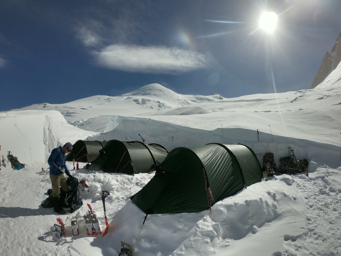
High Camp (17,200 ft) to the Summit of Mt. Denali (20,310 ft)
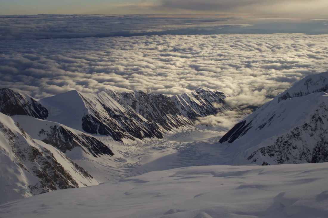
Following a night of tossing and turning in anticipation, we got up out of our tents. It appeared that our forecasts were correct, and the bluebird morning was a good omen as we left our tents behind in pursuit of the summit. Just after leaving camp, one of our instructors, Sara, had to turn around due to some pretty intense altitude sickness that left her with a splitting headache and cough. Since our permit stipulated a four to one student to instructor ratio, two students bravely volunteered to descend with her back to high camp while the 10 of us remaining pushed on. The first few hours were gradual climbing along the upper Harper Glacier, until we reached Denali Pass, the spot where the Muldrow and West Buttress routes meet, at around 18,200 feet.
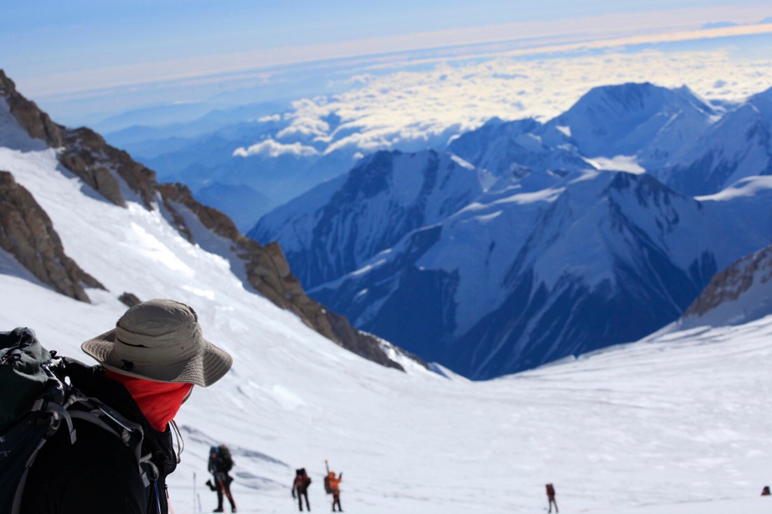
Until Denali Pass, we had spent the previous 22 days completely alone. Not only were the 13 of us the only people on the north side of the mountain, but we would be the only team attempting this route all year. In fact, the NOLS biennial expedition on Denali have been essentially the exclusive attempts on the Muldrow route for over a decade due to the immense challenges of the route. While we didn’t see any other climbers at Denali Pass, we spotted a trail in the snow, the first sign of other human life since departing from Wonder Lake over three weeks before.
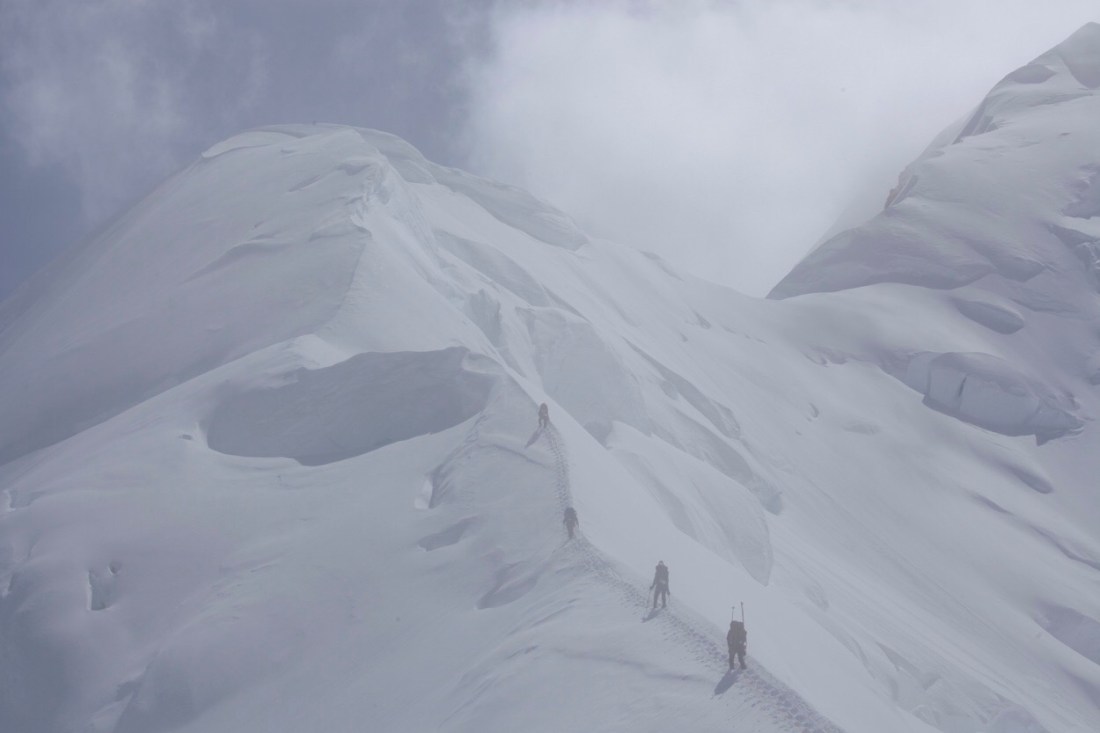
After the pass we had a few sections of steep, exposed climbing as we moved up to and away from Archdeacon’s Tower. We had a long break at the end of the “football field,” a wide flat compression situated just below the summit ridge. As we sat on our packs and looked toward the summit, the only thing in our way was a long steep ramp up to the ridge, and a short climb from there to the summit proper. It was at this moment that we saw our first fellow climbers coming from below, and we waited to let them pass before beginning the slow climb up to the summit ridge. The nearly two hours that succeeded were some of the hardest of my life, as moving up terrain that difficult at 20,000 feet really takes it out of you. The only thing I could focus on was putting one foot in front of the other as I gasped for air and could manage one step every three of four seconds.
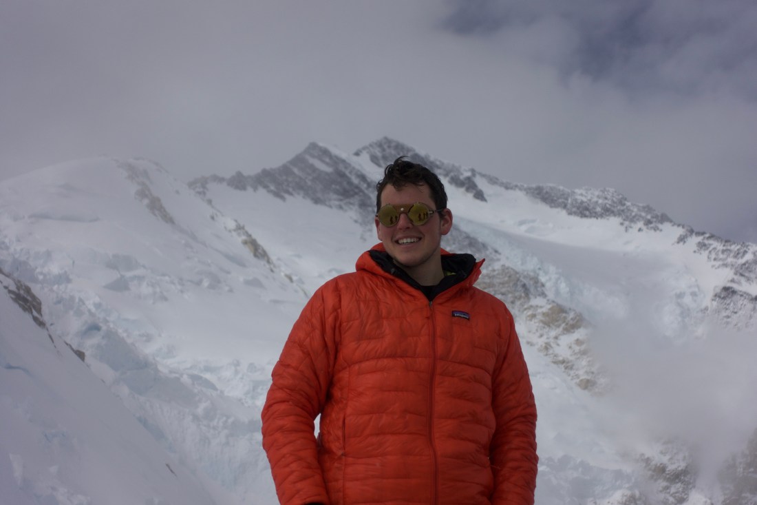
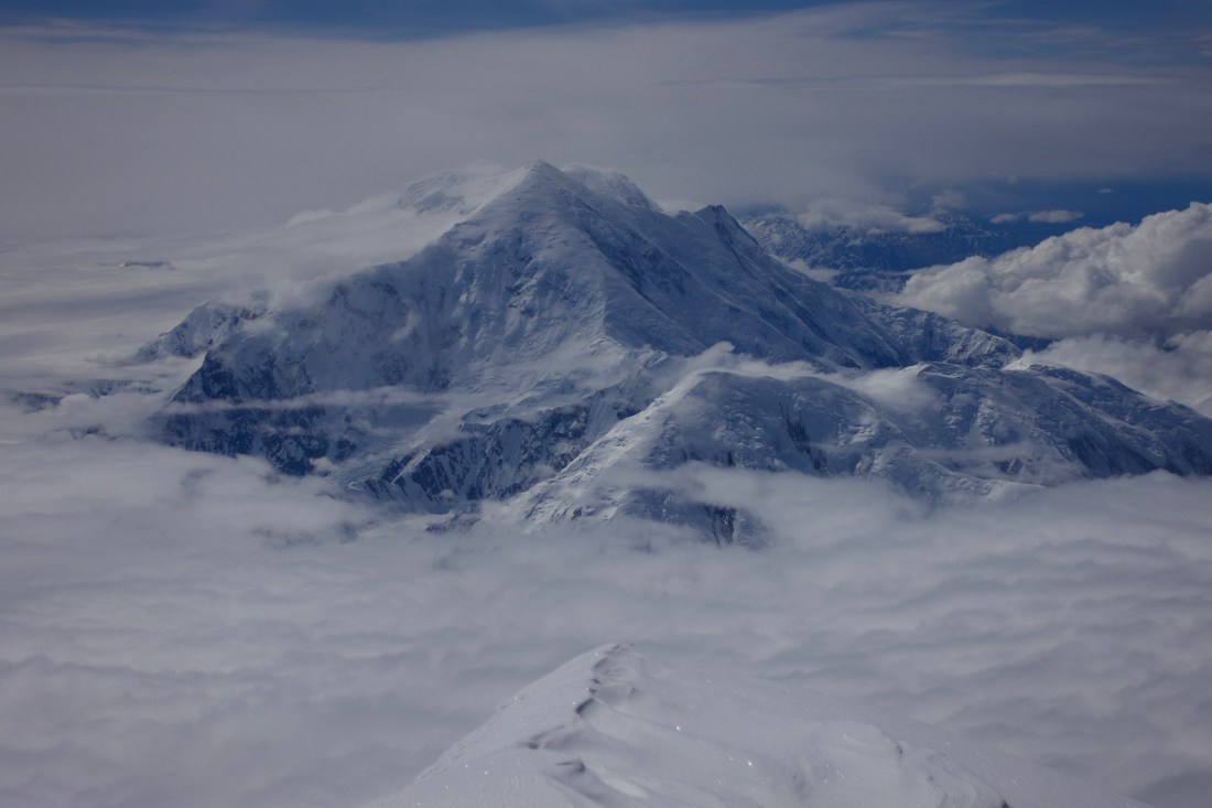
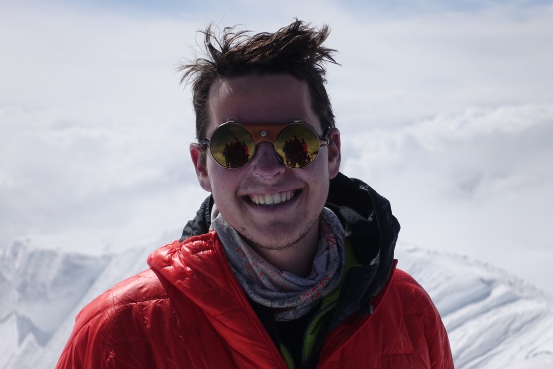
Then, though I thought it was impossible, I found myself standing on the summit of Mt. Denali, overcome with emotion and stunned to have made it. Having worked so hard for something seemingly so elusive, and achieving that goal was an incredible feeling of accomplishment. We took it all in up there as we celebrated, snapped pictures, and enjoyed the views for over an hour at the top.


Summit of Mt. Denali (21,310 ft) to Wonder Lake (1,500 ft)
My jubilation faded as we began to descend back to our camp, and my realization that we were technically only halfway through our journey weighed down on me. My exhaustion and fatigue also seemed to sink in and I was tripping over my own feet as I was so tired I lost control of my body. I stumbled into camp just after 10:00 PM and slept like hibernating grizzly. Unfortunately, my rest was short lived as we had to get up and start heading down the mountain due to Sara’s deteriorating condition.
The following eight days were spent following our exact same route up the mountain, only faster and more efficiently. Most people think that going up the mountain is the hard part, and it’s just a coast to get back to the base. Personally, the descent is my least favorite part of mountaineering, due to the increased difficulty of certain moves. For example, when we hit spots such as the nurdle or other near-vertical ice walls, we couldn’t just continue to put one foot in front of the other, we had to down climb, facing up the mountain and leading with our feet. While the Hill of Cracks had plenty of snow cover on the way up, when we hit it moving down it was completely cracked out and took hours to navigate the many crevasse step overs. Instead of moving quickly on snow along the side of the Lower Ice Fall, we had to do a bit of mixed climbing as the snow had melted out leaving large sections of rock fall to traverse over. All of these aspects, paired with our building fatigue from a month of intense physical punishment and the fact that we had to carry all the gear we had cached, made the descent one of the most difficult parts of the climb. When we finally reached the McKinley River after a single day, nearly 20 mile push from McGonagall pass, everybody was ready to be done. Luckily, the river was passable and the next day we found ourselves on a park bus heading away from the mountain.
I knew what we had accomplished was huge, but I didn’t realize just how big of a deal it was. As we passed rangers and park staff on our way out, we were met with literal applause. Back at the NOLS branch everybody looked at us like heroes, and people were sure to give us space and let us relax after such a demanding expedition. We even heard from the director of Alaska Mountaineering School how impressed he was with our team, and that he believes the Muldrow is the hardest route being done in North America right now.
In the time I’ve had since returning home, I have had a lot of time to process this adventure. It’s incredible how quickly one can forget about the pain, the cold, and the suffering. Immediately upon my arrival in Chicago, I settled right back into the comforts of home and began to romanticize the expedition. It’s impossible to show someone what it’s like to do something like this without them actually doing it, but I hope this post has given you a better sense of my experience. If not, then maybe you should get up there and give it a try.
